
Tree services in Charleston, SC
Plan removal, tree trimming or fallen-tree cleanup using the local checks below. For service scope, start with tree removal, trimming and pruning or storm damage work.
Tree services in Charleston



South Carolina tree-work decisions
In the City of Charleston, tree-review requirements depend on the tree, land use and location, including special buffers. Start with the parcel and Zoning's inspection route, then define the work and disposal. Do not borrow North Charleston or county rules merely because an estimate says 'Charleston area.'
Establish which Charleston authority applies
This guide concerns the City of Charleston, South Carolina. The metro contains separate municipalities and county jurisdictions. Confirm the actual parcel before applying any diameter threshold, form or collection schedule. The city Zoning page provides the tree-inspection request route and information about the city's review bodies.
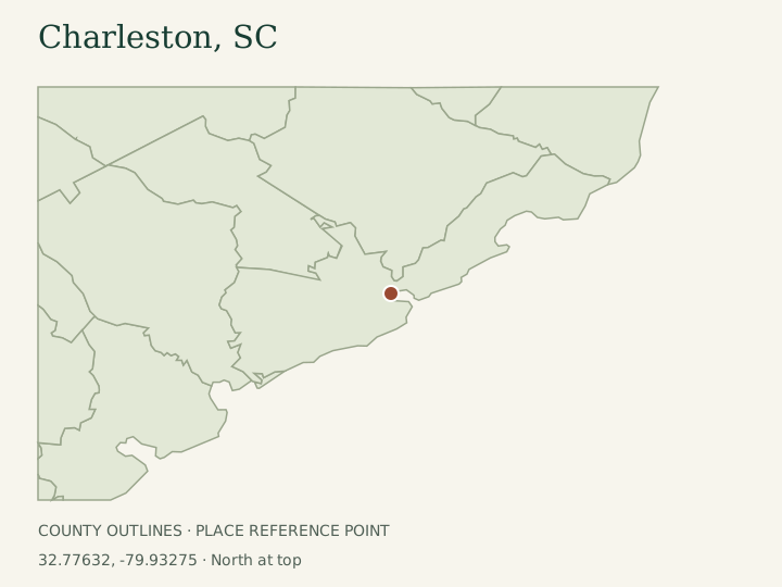
Provide the property's use and proposed operation when asking for guidance. A small residential yard, a multi-unit property and a development site do not necessarily follow the same tree provisions. Identify any buffer, public frontage or existing approval condition. A contractor's service-area description cannot resolve those distinctions, and the locator map on this page shows a county context rather than municipal limits.
Apply tree categories with their exceptions
The city's tree information distinguishes Grand and Protected trees, with species and land-use provisions. Its residential under-twenty-four-inch discussion should not be converted into permission to remove every smaller tree in every location. The page separately addresses critical-line and Daniel Island visual buffers. Ask Zoning to apply the full circumstances to the tree.
Prepare the species, diameter, marked location and reason for work. For condition concerns, the city may request an arborist's documentation. Ask an assessor whether retention or targeted pruning can meet the objective before choosing complete removal. A photograph showing a large crown does not establish trunk diameter or a diagnosis, and a removal recommendation does not itself issue permission.
Use the correct scope for pruning and access
The city's tree page says a permit is not required to prune a Grand or Protected tree, while specifying qualified tree-service work and pruning standards. That statement does not authorize private work on a public tree, clear a utility conflict or settle all site conditions. Describe the proposed branch objective and ask about ownership or location uncertainties first.
For development near a retained Grand tree, the same page identifies protective-zone requirements. Include equipment movement and staging in the discussion, not only the building footprint. A tree may be retained on paper while its surrounding area is treated as an unplanned storage yard. Ask the reviewer and estimator to align the approved protection with the practical work route.
Separate routine collection from a removal load
The current yard-waste page describes weekly separated collection, paper bags for fine material and prepared wood no longer than four feet and four inches in diameter. Those limits are materially different from neighboring municipalities. Large removal wood needs a suitable route rather than a curb pile assumed to disappear on ordinary collection day.
Confirm material-origin and service eligibility directly with Environmental Services, particularly for a contracted job. Ask for complete contractor hauling when the load does not qualify. A cleanup proposal should distinguish branches, logs, chips, stump work and any restoration. The absence of a hauling line in an estimate does not mean the city will provide that part for free.
Confirm the receiving route and current schedule
The county disposal page identifies the McGill-operated Bees Ferry compost route for yard waste with a published one-ton maximum. Confirm the actual material, commercial eligibility and load terms before using it; the page also excludes private and commercial construction-and-demolition loads from Bees Ferry Landfill. A mixed load of branches and building material needs a different decision from clean yard waste.
For example, a homeowner can request tree review, compare a retention assessment with removal, and ask bidders to price complete handling of oversized wood. If a collection schedule appears on a city page, check the current address-based service information rather than treating an old holiday notice as today's instruction. Following a storm, verify any temporary program separately before changing the contract's disposal responsibility.
Questions about this work
Does the city rule cover North Charleston too?
No. Confirm the parcel's actual jurisdiction. North Charleston and unincorporated county areas have their own procedures.
Can I rely only on the tree's diameter?
Species, land use, buffer location and existing site conditions also matter. Ask Zoning to apply the full rule to the proposed operation.
Does a disposal listing guarantee acceptance of my load?
No. Confirm material type, load size and hauler eligibility with the receiving operator before scheduling transport.
Nearby field guides
Great-circle distances between GeoNames place points, not driving distances or service coverage. Showing up to eight nearest published guides.
Preparing your local map…
The map loads automatically as you approach it. City links work without JavaScript.
Distances between GeoNames place points, not driving distances or service coverage. US Census January 2025 state/county boundaries, not municipal limits. Points: GeoNames, CC BY 4.0. Map interface: Leaflet.